
When you want to know the horizontal and vertical variations of the subsoil, the 2D Electrical Resistivity Tomography technique is applied. In this case it is assumed that the variations in resistivity in the subsurface in the direction perpendicular to that of the profile are infinite. With the measurements obtained directly from the field, a two-dimensional image is obtained that allows schematicizing the distribution of electrical resistivity in the subsoil. To carry out electrical tomography, two tetraelectrode arrangements are used, which are the most used: Pole-Dipole , Dipole-Dipole
Applications:

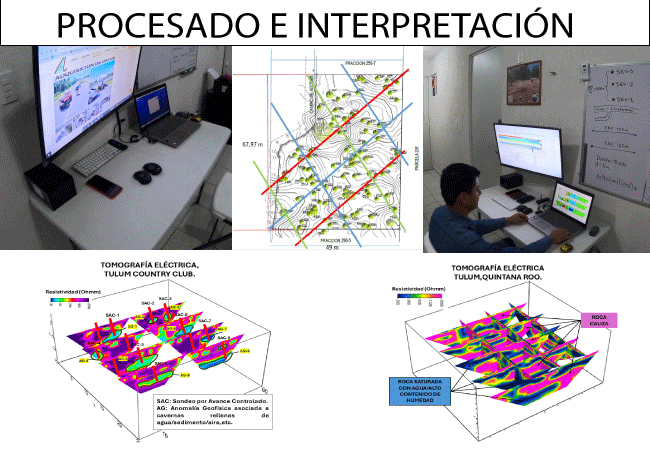
This technique requires a line of electrodes buried in the surface at controlled spacing, a multichannel probe, and a resistivity meter. Data processing consists of an iterative least-squares geophysical inversion process to calculate true resistivity from apparent resistivity values obtained in the field until a model consistent with the geological reality of the site is obtained.
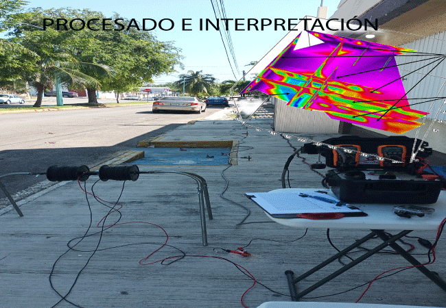
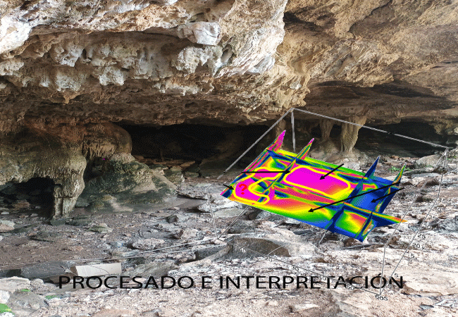
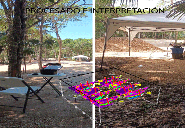
It is developed with the electrode configuration required for each study objective, that is, it consists of estimating the electrical resistivity of the materials that make up the subsoil by driving n number of electrodes (metal rods) equidistantly and injecting electric current with a Resistivity Meter through two electrodes and measuring the voltage variation using two electrodes until completing the entire measurement line.
Using electrical resistivity, we can interpret the possible structures found underground. The structures commonly found in the Riviera Maya are: air caverns, water caverns, hollows, and cenotes. Survey lines are used to cover the largest possible area of the terrain. The maximum investigation depth ranges from 5 to 20 meters, and this may vary due to soil and subsoil conditions. The measurement time will depend on the size of the terrain and can vary from days to weeks depending on weather conditions and access to the terrain..Electrode arrangements: Pole-Dipole, Dipole-Dipole.
Data analysis and management aims to obtain a 2-D model of real resistivities from the pseudosection of apparent resistivities obtained from the ground. This requires an inversion program. These inversion techniques are based on an iterative process to obtain a model of real resistivities, such that the apparent resistivity model it generates is as similar as possible to the pseudosection of apparent resistivities measured in the field..
The integration of 2D electrical resistivity images, geological, geophysical, hydrological, geotechnical and topographic information of the study area will provide us with the interpretation that best approximates the geological reality of the subsoil, and propose the best solution to our clients..All results and conclusions are delivered to the client in a report. Regarding the results, we can conclude that: 1. The cenotes are used for ecotourism projects. 2. The caverns can pose a geological risk when laying foundations for houses or buildings..
The client must provide access for the Tomography surveys, that is, to chop down plants (do not cut down trees), remove trunks and stones with a width of one and a half meters over the entire measurement line in order to be able to manipulate the instrumentation, wiring and probes to carry out the measurements properly..
Send the location via KMZ in Google Earth or the location of the land in real time from WhatsApp, a description of the area and dimensions of the land and, if possible, the topographic plan if you have it to info@geoproyectosmexico.com or to the WhatsApp number: 9842400595,or or call us 1 (800) 605-5408.
Costs are provided per linear meter for Electrical Tomography, starting from $250 to $300, depending on the terrain to be sampled. Additionally, the cost of the report, which starts from $5,000 to $15,000, depends on the amount of data to be processed. Prices will also fluctuate depending on the number of linear meters, distances, and access to the lot.We know how important it is to make a project feasible prior to its completion, which is why we place our conventional communication channels at your service.


© Darcom S.I.S.A - 2022 | All Right Reserved. Diseño Darcom S.I.S.A